🌐 Module V: Specialized Surveys – Hydrographic, Mine & Photogrammetry
“Precision meets depth and elevation — advanced surveying for water, land, and 3D spatial capture.”
| TVET CDACC Unit Code | Unit Title | Duration (Hours) | Credit Factor |
|---|---|---|---|
| LSM/OS/LM/CR/03/6/MA | Mine Survey | 120 | 12 |
| LSM/OS/LM/CR/02/6/MA | Hydrographic Survey | 120 | 12 |
| LSM/OS/LM/CR/04/6/MA | Photogrammetric Survey | 240 | 24 |
🎯 Why This Module Matters
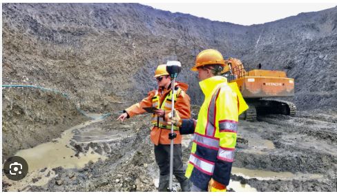
- Mine Surveying introduces learners to underground measurement techniques vital for mineral exploration and safety.
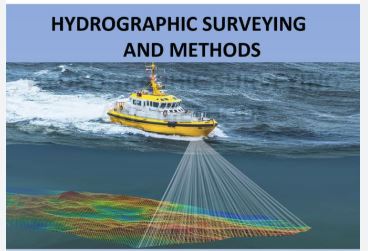
- Hydrographic Surveying builds capacity for mapping water bodies — essential for marine navigation, infrastructure, and flood planning.
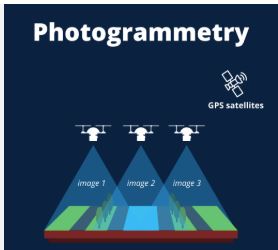
- Photogrammetry unlocks 3D spatial mapping skills used in construction, planning, and smart city models.
📡 Why It’s Relevant to Land Surveyors
- These specialized skills increase your value in industries like mining, marine infrastructure, and geospatial modeling.
- Photogrammetry allows for cost-effective aerial surveys using drones and remote sensing technology.
- You’ll be positioned for government projects, environmental work, and consultancy in high-precision survey sectors.
Unit Description
This unit describes the competencies required by a surveyor to conduct hydrographic survey reconnaissance, conduct shore control survey, establish positions of sea features and prepare hydrographic charts.
Unit Description
This unit describes the competencies required to by a land surveyor to conduct mining survey. It includes conducting mining survey reconnaissance, set out mine works, conduct mapping, and prepare mine plans and
reports.
Unit Description
This unit describes the competencies required by a land surveyor to conduct a photogrammetric survey. It includes conducting photogrammetric survey reconnaissance, conduct image acquisition, conduct
mapping, and prepare photomap.